File:Germany, Federal Republic of location map January 1957 - October 1990.svg
Jump to navigation
Jump to search

Size of this PNG preview of this SVG file: 506 × 599 pixels. Other resolutions: 203 × 240 pixels | 405 × 480 pixels | 507 × 600 pixels | 648 × 768 pixels | 865 × 1,024 pixels | 1,075 × 1,273 pixels.
Original file (SVG file, nominally 1,075 × 1,273 pixels, file size: 490 KB)
Summary
| Description |
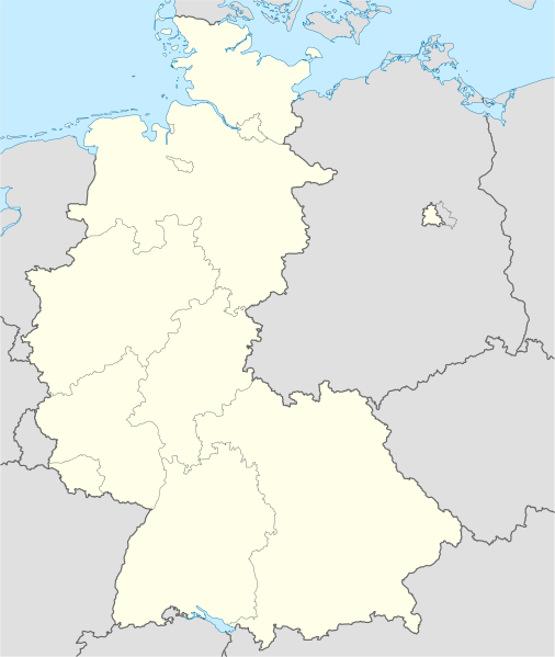
Deutsch: Positionskarte der Bundesrepublik Deutschland. Diese Karte zeigt die Bundesrepublik im Gebietsstand zwischen Januar 1957 bis Oktober 1990.
Quadratische Plattkarte, N-S-Streckung 150 %. Geographische Begrenzung der Karte:
English: Location map of Federal Republic of Germany. Map shows West-Germany as of January 1957 till October 1990.
Equirectangular projection, N/S stretching 150 %. Geographic limits of the map:
|
||
| Date | Created in 2009 | ||
| Source | own work, based on File:Germany location map.svg | ||
| Author | TUBS | ||
| Permission (Reusing this file) |
I, the copyright holder of this work, hereby publish it under the following licenses:
This file is licensed under the Creative Commons Attribution-Share Alike 3.0 Unported license.
You may select the license of your choice. |
||
| Other versions |
Derivative works of this file: Bundesrepublik Deutschland (vor 1990 nur West-Deutschland):
Deutsche Demokratische Republik (mit BRD im Ausschnitt):
Ostdeutschland (vor 1990 Deutsche Demokratische Republik):
Deutschland zwischen Mai 1945 und Oktober 1949:
Thematisch:
Deutsches Reich (1918–1945) (best used with this template (de)):
|


_23_May_1949_-_6_Oct_1949.svg)


_location_map.svg)
_location_map_2013.svg)


.svg)
.svg)
File history
Click on a date/time to view the file as it appeared at that time.
| Date/Time | Thumbnail | Dimensions | User | Comment | |
|---|---|---|---|---|---|
| current | 16:53, 16 September 2013 | | 1,075 × 1,273 (490 KB) | NordNordWest | Reverted to version as of 08:36, 16 September 2013; your are destroying the location map function of this map |
File usage
The following 3 pages use this file: