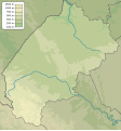
File:Lviv province physical map.svg
Jump to navigation
Jump to search


Size of this PNG preview of this SVG file: 533 × 571 pixels. Other resolutions: 224 × 240 pixels | 448 × 480 pixels | 560 × 600 pixels | 717 × 768 pixels | 956 × 1,024 pixels.
Original file (SVG file, nominally 533 × 571 pixels, file size: 632 KB)
File history
Click on a date/time to view the file as it appeared at that time.
| Date/Time | Thumbnail | Dimensions | User | Comment | |
|---|---|---|---|---|---|
| current | 22:25, 18 December 2023 |  | 533 × 571 (632 KB) | Arvedui89 | After thirteen years I've added an ''actual'' border between Poland and Transcarpathian oblast and missing until this day border between Ivano-Frankivsk and Transcarpahian oblasts. |
File usage
The following 2 pages use this file: