File:Map Toulouse.jpg
Jump to navigation
Jump to search


Size of this preview: 528 × 600 pixels. Other resolutions: 211 × 240 pixels | 422 × 480 pixels | 676 × 768 pixels | 901 × 1,024 pixels | 1,865 × 2,119 pixels.
Original file (1,865 × 2,119 pixels, file size: 4.59 MB, MIME type: image/jpeg)
Summary
| Description |
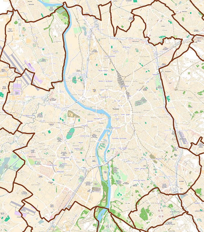
Français : Carte de Toulouse, 31000, France
English: Map of Toulouse, 31000, France |
| Date | |
| Source | You may find a page on the OpenStreetMap wiki page for Toulouse |
| Creator |
OpenStreetMap contributors OpenStreetMap contributors |
| Permission (Reusing this file) |
OpenStreetMap data and maps are licensed under the Creative Commons Attribution-ShareAlike 2.0 license (CC-BY-SA 2.0). This file is licensed under the Creative Commons Attribution-Share Alike 2.0 Generic license.
|
| Georeferencing | If inappropriate please set warp_status = skip to hide. |
Licensing
This file is licensed under the Creative Commons Attribution-Share Alike 3.0 Unported license.
- You are free:
- to share – to copy, distribute and transmit the work
- to remix – to adapt the work
- Under the following conditions:
- attribution – You must give appropriate credit, provide a link to the license, and indicate if changes were made. You may do so in any reasonable manner, but not in any way that suggests the licensor endorses you or your use.
- share alike – If you remix, transform, or build upon the material, you must distribute your contributions under the same or compatible license as the original.
File history
Click on a date/time to view the file as it appeared at that time.
| Date/Time | Thumbnail | Dimensions | User | Comment | |
|---|---|---|---|---|---|
| current | 20:50, 23 October 2011 | | 1,865 × 2,119 (4.59 MB) | XIIIfromTOKYO | {{Information |Description ={{en|1=Map of Toulouse, France}} {{fr|1=Carte de Toulouse, France}} |Source ={{openstreetmap}} |Author =OpenStreetMap contributors |Date =2011-10-23 |Permission = |other_versions = }} [[Categor |
File usage
The following 2 pages use this file: