This file is from Wikimedia Commons and may be used by other projects.
The description on its file description page there is shown below.
Summary
Licensing
You are free:
to share – to copy, distribute and transmit the workto remix – to adapt the work
Under the following conditions:
attribution – You must give appropriate credit, provide a link to the license, and indicate if changes were made. You may do so in any reasonable manner, but not in any way that suggests the licensor endorses you or your use.share alike – If you remix, transform, or build upon the material, you must distribute your contributions under the same or compatible license as the original. https://creativecommons.org/licenses/by-sa/3.0 CC BY-SA 3.0 Creative Commons Attribution-Share Alike 3.0 true true
Original upload log
This image is a derivative work of the following images:
File:Syria_location_map.svg licensed with Cc-by-sa-3.0, GFDL
2010-09-30T19:34:14Z NordNordWest 922x762 (250221 Bytes) Reverted to version as of 08:25, 29 September 2010: NO CHANGES WITHOUT DISCUSSION
2010-09-30T19:08:16Z Supreme Deliciousness 1000x827 (246114 Bytes) All sources on talkpage show with the same color
2010-09-29T08:25:21Z NordNordWest 922x762 (250221 Bytes) Reverted to version as of 18:29, 29 November 2008: no changes without discussion
2010-09-29T00:36:20Z Supreme Deliciousness 1000x827 (246114 Bytes) Reverted to version as of 18:38, 22 August 2008
2008-11-29T18:29:45Z NordNordWest 922x762 (250221 Bytes)
2008-08-22T18:38:21Z NordNordWest 1000x827 (246114 Bytes) {{Information |Description= {{de|Positionskarte von [[:de:Syrien|Syrien]]}} Quadratische Plattkarte, N-S-Streckung 115 %. Geographische Begrenzung der Karte: * N: 37.6° N * S: 32.0° N * W: 34.9° O * O: 42.7° O {{en|Locati File:Syria_physical_map.svg licensed with PD-self
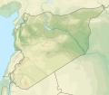
2011-02-14T20:13:58Z Urutseg 427x394 (750128 Bytes) {{Information |Description ={{en|1=Syria map, parameters equal to [[:File:Syria location map.svg]]}} |Source ={{own}} |Author =[[User:Urutseg|Urutseg]] |Date =2011-02-14 |Permission = |other_v English Add a one-line explanation of what this file represents
Arabic خربة الخذراف التابعة لبلدية المسعودية تقع غرب مدينة مسكنة ب15كم وشرق حلب 85كم تبعد عن بحيرة الاسد 20كم وتقع وسط منطقة زراعية تشتهر بزراعة القمح والقطن
File history
Click on a date/time to view the file as it appeared at that time.
Date/Time Thumbnail Dimensions User Comment current 15:07, 18 November 2022 921 × 806 (972 KB) GrandEscogriffe more correct N/S stretching
File usage
The following 2 pages use this file:
This file contains additional information, probably added from the digital camera or scanner used to create or digitize it.
If the file has been modified from its original state, some details may not fully reflect the modified file.


