Module:Location map/data/Austria Salzburg
Jump to navigation
Jump to search

| name | Salzburg | |||
|---|---|---|---|---|
| border coordinates | ||||
| 48.0767055 | ||||
| 12.0100138 | ←↕→ | 14.0424444 | ||
| 46.8998111 | ||||
| map center | 47°29′18″N 13°01′34″E / 47.4882583°N 13.0262291°E | |||
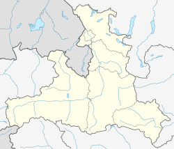
| image | Austria Salzburg location map.svg
| |||

| ||||
Module:Location map/data/Austria Salzburg is a location map definition used to overlay markers and labels on an equirectangular projection map of Salzburg. The markers are placed by latitude and longitude coordinates on the default map or a similar map image.
Usage
These definitions are used by the following templates when invoked with parameter "Austria Salzburg":
{{Location map|Austria Salzburg |...}}{{Location map many|Austria Salzburg |...}}{{Location map+|Austria Salzburg |...}}{{Location map~|Austria Salzburg |...}}
Map definition
name = Salzburg- Name used in the default map caption
image = Austria Salzburg location map.svg- The default map image, without "Image:" or "File:"
top = 48.0767055- Latitude at top edge of map, in decimal degrees
bottom = 46.8998111- Latitude at bottom edge of map, in decimal degrees
left = 12.0100138- Longitude at left edge of map, in decimal degrees
right = 14.0424444- Longitude at right edge of map, in decimal degrees
Precision
Longitude: from West to East this map definition covers 2.0324 degrees.
- At an image width of 200 pixels, that is 0.0102 degrees per pixel.
- At an image width of 1000 pixels, that is 0.002 degrees per pixel.
Latitude: from North to South this map definition covers 1.1769 degrees.
- At an image height of 200 pixels, that is 0.0059 degrees per pixel.
- At an image height of 1000 pixels, that is 0.0012 degrees per pixel.
Examples using location map templates
Location map, using default map (image)
Salzburg
Salzburg (Salzburg)
{{Location map | Austria Salzburg
| width   = 200
| lat_deg = 47.8
| lon_deg = 13.033333
| label   = Salzburg
}}
See also
Location map templates
- Template:Location map, to display one mark and label using latitude and longitude
- Template:Location map many, to display up to nine marks and labels
- Template:Location map+, to display an unlimited number of marks and labels
Creating new map definitions
return {
	name = 'Salzburg',
	top = 48.0767055,
	bottom = 46.8998111,
	left = 12.0100138,
	right = 14.0424444,
	image = 'Austria Salzburg location map.svg'
}